Google Map Properties

These properties affect the Google Map component.

For a guide to using the Google Map component, see Google Map.

Google Map components are also affected by Common Properties.

Google Map properties
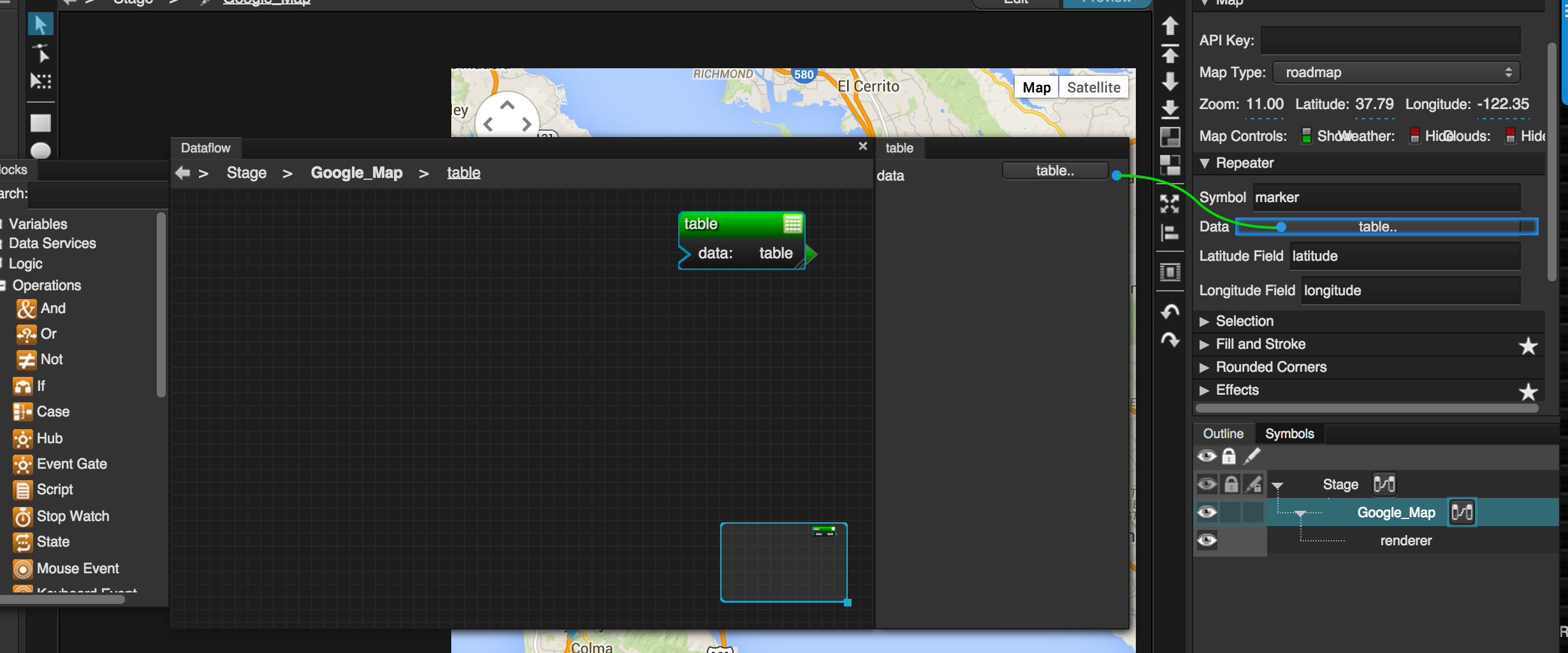
Google Map properties in the Property Inspector

These properties affect the map:

API Key

API Key

API Key
Specifies the Google Maps API key to use.

You are responsible for the use of Google Maps and for compliance with Google's licensing. For details, please see Google's Terms of Service for Google Maps and Google Earth.

The API Key property

Map Type

Map Type

Map Type
Defines the type of Google Map to be displayed in the component.

Roadmap
The default road map view.

Satellite
Google Earth satellite images.

Hybrid
A mixture of road map and satellite images.

Terrain
A physical map based on terrain data.

The Map Type property

Latitude

Latitude

Latitude
Sets or returns the latitude at the center of the map component.

The Latitude property

Longitude

Longitude

Longitude
Sets or returns the longitude at the center of the map component.

The Longitude property

Zoom

Zoom

Zoom
Sets or returns the zoom level for the map. Zero is the lowest zoom level, in which the entire world can be seen in one map. For each map type, valid zoom levels are from 0 to the maximum zoom level for that location and map type. The maximum depends on available data and is typically between 18 and 21 for a given location and map type.

The Zoom property
The Zoom property

Map Controls

Map Controls

Map Controls
Specifies whether to show map controls, allowing the user to manipulate the map. Controls allow the user to zoom in or out, and move left, right, down, or up.

The Map Controls property

Traffic

Traffic

Traffic
Specifies whether to show the Google Maps Traffic Layer on the map.

The Traffic property

These properties affect the map repeater:

Symbol

Symbol

Symbol
Defines the symbol to be used as a location marker. If the symbol is in this project, enter the name of the symbol. To use a symbol from another project in your library, enter the path to that symbol.

The Symbol property
The Symbol property

Data

Data

Data
Defines the table from which latitude and longitude data for location markers can be determined. By default, Google Map has a table case block that you can play with.

The Data property
The Data property

To use the default table:

  1. In the Outline, double-click the dataflow icon of your Google Map component.
  2. Select the table case block in dataflow so you can see the properties.
  3. Hover over the table button until a blue dot appears. Then, click the blue dot and drag it over to the Data property.

|

Latitude Field, Longitude Field

Latitude Field, Longitude Field

Latitude Field, Longitude Field
Define the columns in your table that contain latitude and longitude data.

To use the latitude and longitude columns from the default table, enter latitude and longitude.

The Latitude Field and Longitude Field properties

The following properties affect the map group. A map group is useful when you want to have multiple repeaters, or other components, in your map, or when you want your markers to be placed at each set of coordinates without being centered on the location.

Symbol

Symbol

Symbol
Defines the symbol to be used as a location marker in this map group. If the symbol is in this project, enter the name of the symbol. To use a symbol from another project in your library, enter the path to that symbol.