Map Group
The map group component serves two main functions:
- It holds any components that you want to place at longitude and latitude locations on a Google Map.
It can manage a repeater in a Google Map component. Using more than one map group, you can make multiple repeaters for the same map.
Although the Google Map component can manage one repeater without a map group, map groups are required if you want more than one repeater, or if you want to place items at map coordinates without centering each item on its location.
The position properties for elements inside a map group component are special, because these properties position the elements geographically.
- The Left or Right position property determines the longitude of the left or right boundary of the element.
- The Top or Bottom position property determines the latitude of the top or bottom boundary of the element.
- The Horizontal Center position property determines the longitude of the horizontal center of the element.
- The Vertical Center position property determines the latitude of the vertical center of the element.
Note
Map groups are for the Google Map component. For the Mapbox GL Map and ESRI Map components, use Insert > Components > Mapbox Group or ESRI Map Group, which work the same way.
Place Components at Geographic Locations
To create a map group whose components are placed at longitude and latitude coordinates on the map:
- Create a Google Map component.
In the Outline, right-click the Google Map component, and select Insert > Components > Map Group.
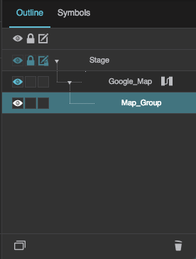
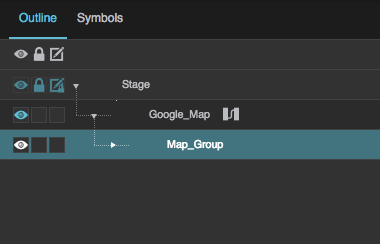
The map group is added as a child of the Google Map.
Right-click the map group, and select Insert > Components > Text.
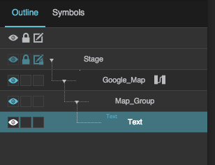
A text component is added as a child of the map group.
Expand the Position and Size properties for the text component.
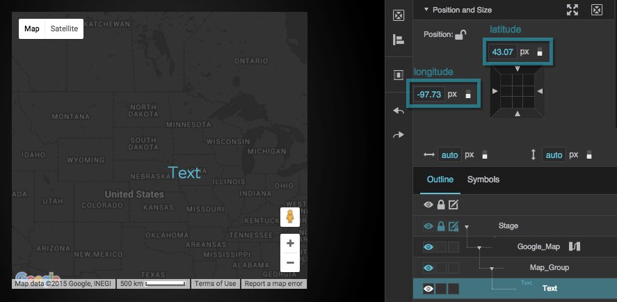
The position properties for elements inside the map group are special, because these properties position the elements geographically as described above.
In the Position and Size properties, in the 9-square gadget, click the left or right side and then specify a longitude value to which you want to align that side.
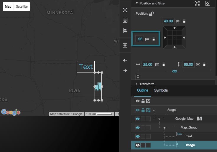
The left side of the image component is aligned to 92° west (−92°).
The right side of the text component is aligned to 92° west (−92°).Click the top or bottom side and then specify a latitude value to which you want to align that side.
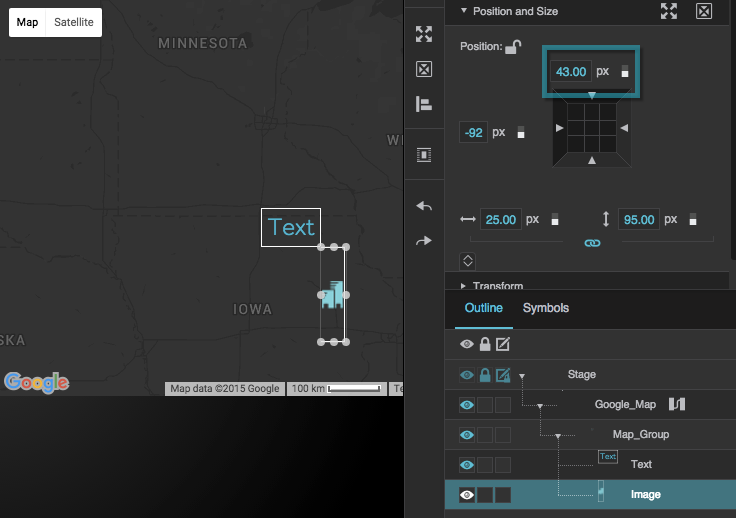
The top of the image component is aligned to 43° north (43°).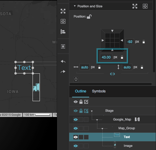
The bottom of the text component is aligned to 43° north (43°).
Create a Map Group Repeater
A map group repeater can place items at latitude and longitude locations according to a table.
Before you can create a map group repeater, you must create a symbol for the repeater to use. You can create symbol parameters for latitude and longitude, and bind the latitude and longitude parameters to the Position and Size properties of the symbol root.

The map group repeater will use these position properties to place the symbol instances geographically, as described above.
To create a map group repeater:
- Create a Google Map component.
In the Outline, right-click the Google Map component, and select Insert > Components > Map Group.
The map group is added as a child of the Google Map.
Select the map group in the Outline, and then open the Symbols panel.
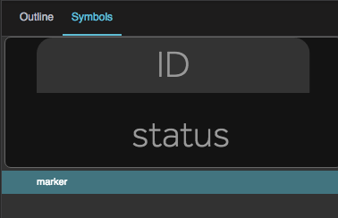
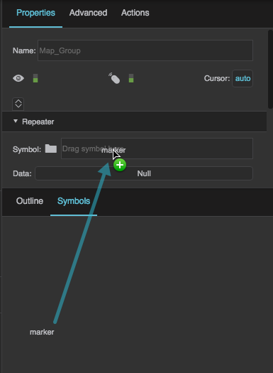
Drag the symbol from the symbols panel to the the Symbol property, in the Property inspector, under Repeater.
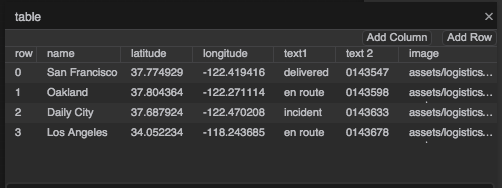
Load the data that you want to use, including the latitude and longitude data.
You can do this by deleting the existing table and loading a new one as discussed in Working with Tables. Or, you can open the existing table and edit it manually.
Your table must include columns for any parameter values that you want to be driven by the table, such as image paths, labels, or color codes.
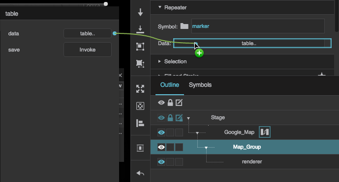
Bind the dataflow table to the Data property of the map group.
In the Outline, select the "renderer" node that is a child of the map.
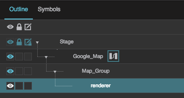
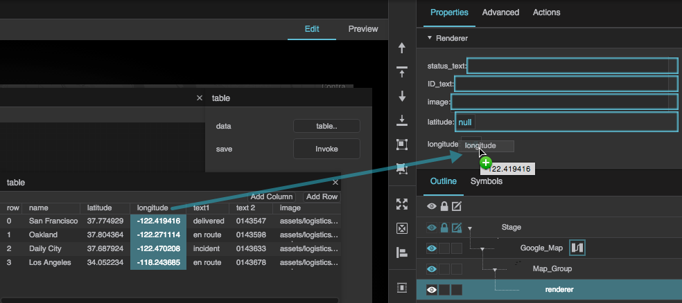
In the Property Inspector, for each symbol parameter, either enter a value or bind a table column.
To bind a table column, open the table in dataflow and drag the column header to this field.
 Dataflow icon next to the Google Map component.
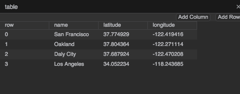
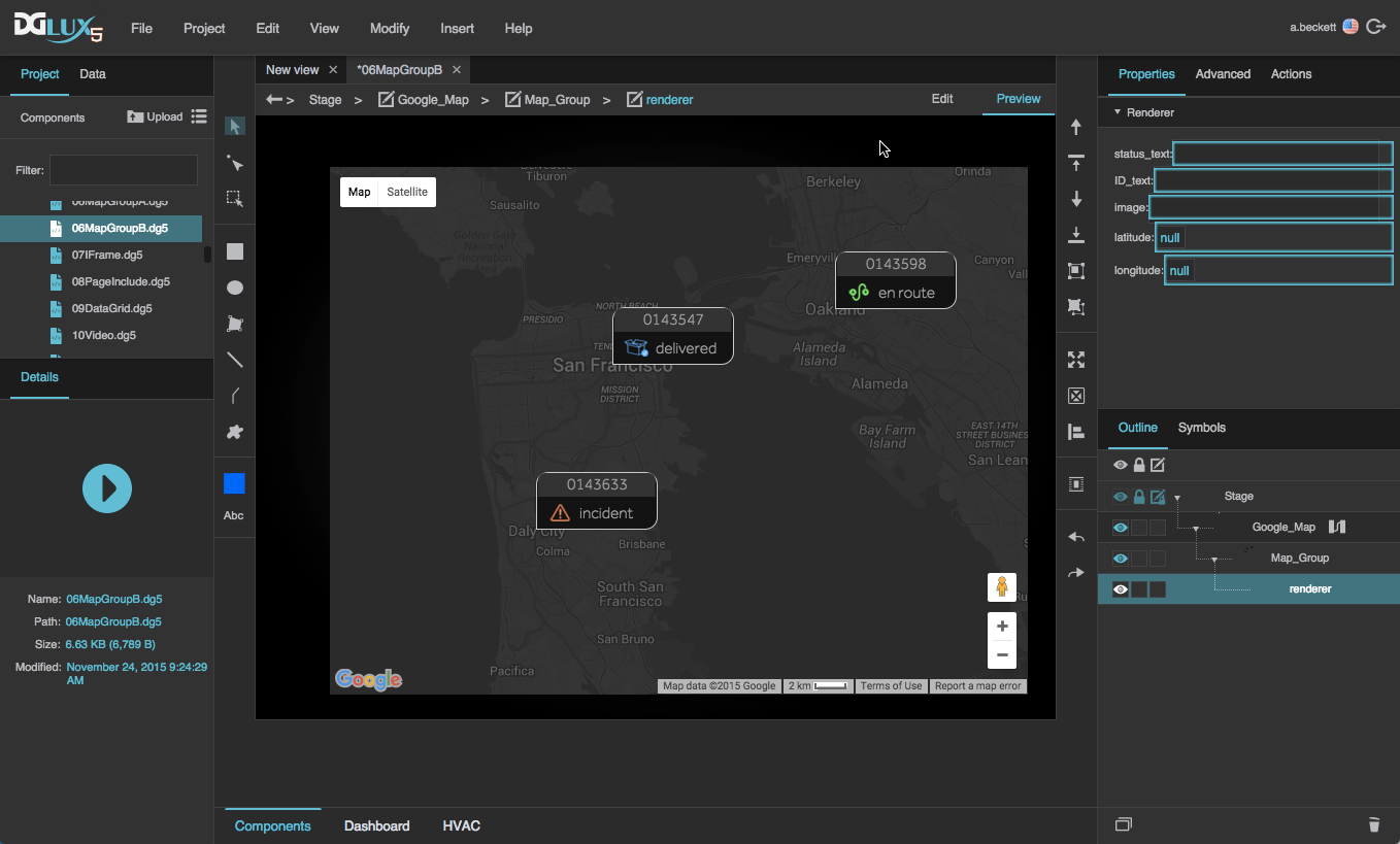
Instead of binding the position properties of the symbol, you can also enter the names of the table columns that contain the coordinates in the Latitude Field and Longitude Field properties of the Repeater section. Each symbol instance is then placed at its location.
To group nearby markers into clusters when the map is zoomed out, set the map group's cluster property to TRUE in the Advanced properties. Optionally set clusterImagePath to the location of the cluster icon images.